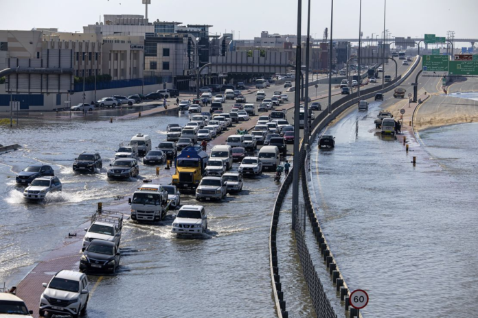
Unprecedented, torrential rainfall plunged parts of the United Arab Emirates underwater last week, bringing life to a standstill in Dubai and elsewhere.
The flooding that resulted from the UAE’s largest deluge on record was so intense that satellites were still able to see it from space days after the clouds cleared and the last drops of rain fell.
A firehose of heavy rain gushed over a large portion of the UAE from late Tuesday, April 16, through Wednesday, April 17. Dubai – the country’s most populous city – recorded a year’s worth of rain in just 12 hours as areas farther east recorded nearly 2 years’ worth of rain in under 24 hours.
The heaviest rain targeted areas north and east of the country’s capital city of Abu Dhabi. Rainfall totals of 4 to 8 inches (about 100 to 200 mm) were common, but a few locations recorded nearly 10 inches (250 mm).
Floodwaters rose quickly and were slow to recede as a result of the historic deluge, which was the most extreme event in the country since records began 75 years ago.
Less than two days after the rain relented, the Landsat 9 satellite passed over the UAE on Friday, April 19, and captured images of large, lingering pools of floodwater. The satellite collects detailed imagery of Earth’s surface and is operated by NASA and the United States Geological Survey.
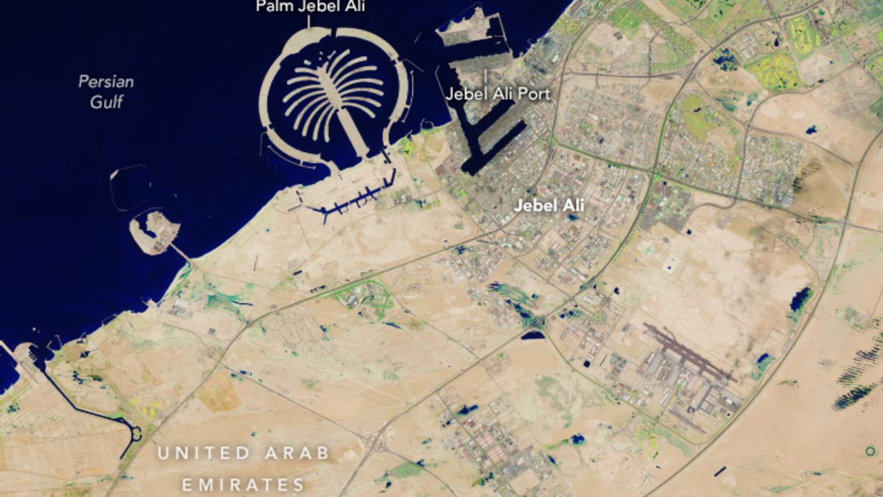
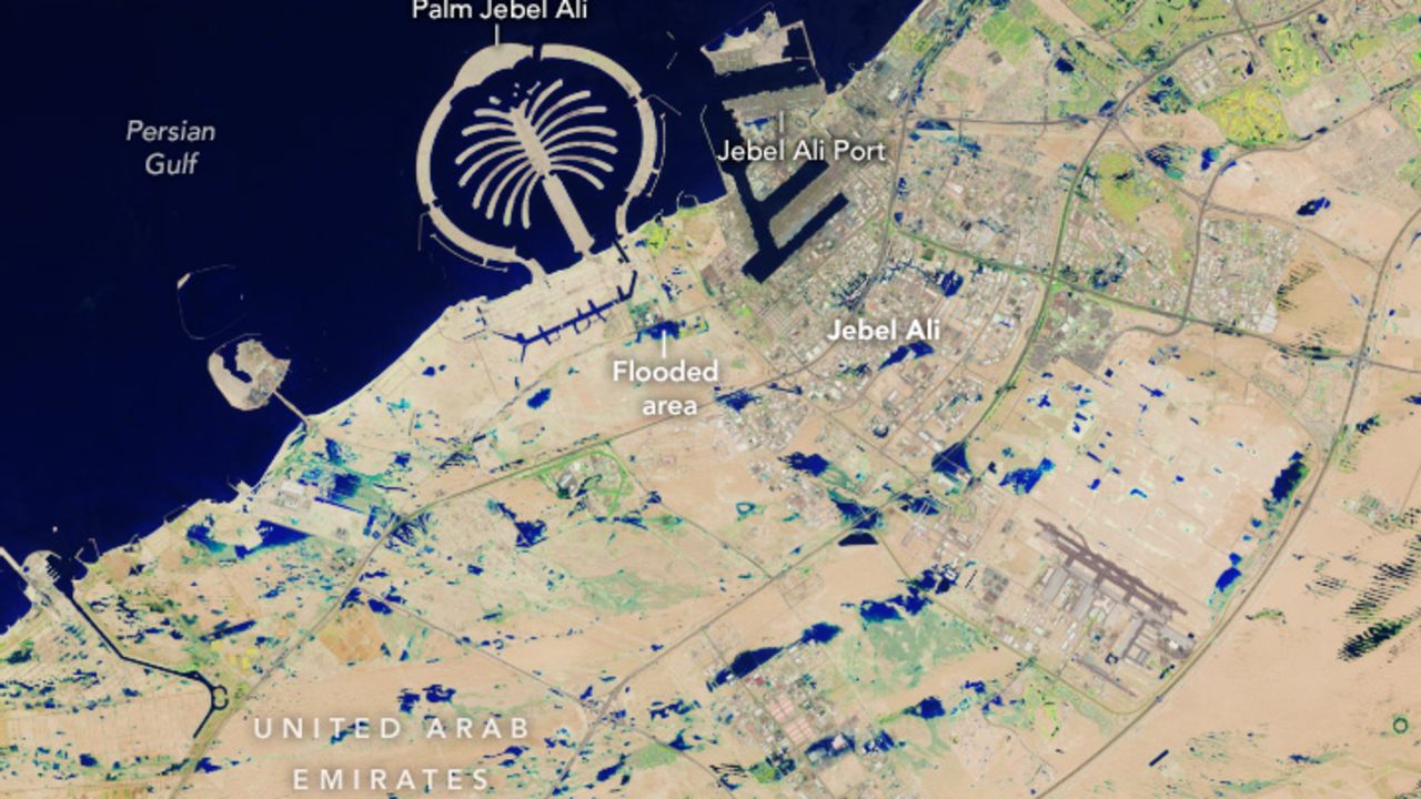
Images taken over the Jebel Ali area, located on the southern outskirts of Dubai, capture the area before and after historic flooding. NASA
Pools of deep blue in the images above highlight floodwaters that stand in stark contrast against the region’s typically dry ground, which appears tan or light brown. The flooding shown is in the southernmost portion of Dubai, but the city’s highly urbanized central hub isn’t captured.
These images were taken with Landsat 9’s false color products to make the presence of water stand out against the dry ground. The colors shown are not exactly how they would appear to a person peering down from space, but make differences in the land easier to spot.
The satellite also captured significant flooding in Abu Dhabi. Small, shallow bodies of water appear light blue. The larger and deeper pools of floodwater are dark blue.
Large sections of dry, tan ground also gain a light green tint after the rainfall. This likely shows that the ground in many areas retained a dampness from the rain, even if they did not fully flood.
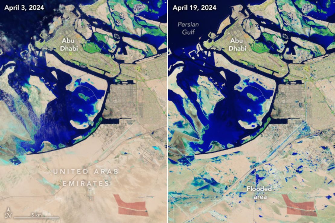
Satellite imagery captures Abu Dhabi before (left) and after (right) historic flooding. NASA
While these images may have missed out on the absolute worst extent of flooding in the country, they provide an incredible snapshot of just how much the stormy weather left behind.
The torrential rain was associated with a larger storm system last week traversing the Arabian Peninsula and moving across the Gulf of Oman. This same system also brought deadly flooding to nearby Oman.
Extreme rainfall events like this are becoming more common as the atmosphere warms due to human-driven climate change. A warmer atmosphere is able to soak up more moisture like a towel and then ring it out in the form of torrential rainfall.
Dry areas that lack the infrastructure to deal with intense rain are more likely to struggle with bouts of significant flooding as a result.
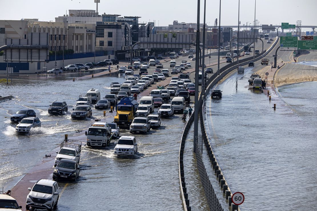
Vehicles drive through floodwater caused by heavy rain in Dubai on Thursday. Christopher Pike/AP
MORE:

